Description
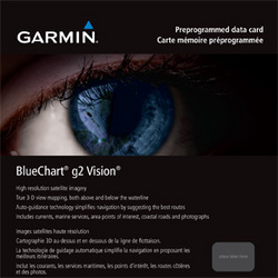
The Garmin BlueChart G2 Vision MicroSD SD Card is a high-quality mapping and graphics card that covers the coast of southern Africa from Namibe, Angola to Angoche, Mozambique, including the South African cities of Cape Town and Port Elizabeth. The card also includes detailed coverage of Durban, South Africa and Maputo, Mozambique. The card also includes detailed coverage of the Tristan da Cunha Group, the island of St. Helena, and the Prince Edward Islands. The card's premium mapping and graphics capabilities include detailed nautical charts, in vector object-oriented format, derived from government charts and private sources to provide port plans, depth contours, navigational aids, and tides and currents in a seamless chart presentation. The card also includes shaded depth contours and inter-tidal zones with spot soundings. The card's aerial photos of ports, marinas, bridges and navigational landmarks and realistic "view from space" high-resolution satellite imagery are also very realistic. The card's up to 1-foot HD contours provide a more accurate depiction of bottom structure for improved fishing charts and navigation in swamps, canals, marinas and port plans. The card's Garmin Auto Guidance 3.0 technology
Coverage:
- The coast of southern Africa from Namibe, Ang. to Angoche, Moz., including the South African cities of Cape Town and Port Elizabeth. Includes detailed coverage of Durban S. Af. and Maputo, Moz. Also includes detailed coverage of the Tristan da Cunha Group, the island of St. Helena, and the Prince Edward Islands.
Premium Mapping and Graphics Capabilities
- Detailed nautical charts, in vector object-oriented format, derived from government charts and private sources to provide port plans, depth contours, navigational aids, and tides and currents in a seamless chart presentation
- Shaded depth contours and inter-tidal zones with spot soundings
- Aerial photos of ports, marinas, bridges and navigational landmarks and realistic "view from space" high-resolution satellite imagery
- Up to 1-foot HD contours provide a more accurate depiction of bottom structure for improved fishing charts and navigation in swamps, canals, marinas and port plans
- Garmin Auto Guidance 3.0 technology is now capable of providing routing guidance¹ to virtually any accessible destination on the water
- Worldwide coverage available in regionalized cuts
