Historic Map - Custer's Battle-field June 25TH 1876 Surveyed And 1876 U.s. Army Corps Of Engineers V1 24IN X 22IN


Historic Map - Custer's Battle-field June 25TH 1876 Surveyed And 1876 U.s. Army Corps Of Engineers V1 24IN X 22IN
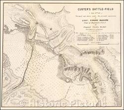
This is a reproduction of a historical map of the Battle of the Little Bighorn. The map was surveyed and created by the U.S. Army Corps of Engineers in 1876. more details
Key Features:
  • The map covers the Battle of the Little Bighorn and the surrounding area
  • It includes key features and terrain of the area
  • It is a reproduction of an historical map


R2 050.00 from WantItAll.co.za

price history Price history

BP = Best Price   HP = Highest Price

Current Price: R2 050.00

loading...

 Comparing 1 offers

Features
Brand Unbranded
Manufacturer Unbranded
Model Number B07RVLGP8F
Description
This is a reproduction of a historical map of the Battle of the Little Bighorn. The map was surveyed and created by the U.S. Army Corps of Engineers in 1876.

Custer's Battle-Field (June 25th, 1876) Surveyed and , 1876, U.S. Army Corps of EngineersWe print high quality reproductions of historical maps, photographs, prints, etc. Because of their historical nature, some of these images may show signs of wear and tear - small rips, stains, creases, etc. We believe that in many cases this contributes to the historical character of the item.
This site is protected by reCAPTCHA and the Google Privacy Policy and Terms of Service apply.