Flower Route West Coast & Namaqualand Road Map


Flower Route West Coast & Namaqualand Road Map
(This title is available on demand : expected date of dispatch will be 4-7 working days once ordered)
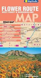
Detailed exploring map of flower route region: At 1: 417 000 scale; information boxes on activities and facilities available; over 45 detailed flower identification photos. Includes: entire route from Cape Town to the Namibian border; Richtersveld national park; Namaqua nation... more details

price history Price history

BP = Best Price   HP = Highest Price

Current Price: R97.00

loading...
Features
Author mapstudio
Format sheet map (folded)
Publisher map studio
Manufacturer Map Studio
Description
(This title is available on demand : expected date of dispatch will be 4-7 working days once ordered)
Detailed exploring map of flower route region: At 1: 417 000 scale; information boxes on activities and facilities available; over 45 detailed flower identification photos. Includes: entire route from Cape Town to the Namibian border; Richtersveld national park; Namaqua national park; West Coast national park; Cederberg. Street plans: new Vanrhynsdorp street plan; Malmesbury; Lamberts Bay; Citrusdal; Clanwilliam; Springbok; a double-sided information map supporting responsible. Land use & promoting tourism attractions and contact information.
There are no offers currently available for this product. The last offer was seen on 11/05/2017 from takealot.com for R97.00
This site is protected by reCAPTCHA and the Google Privacy Policy and Terms of Service apply.