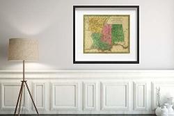
1830 School Atlas Map|alabama Mississippi Louisiana & Arkansas Ter. J.h. Young Sc. Philadelphia: John Grigg No. 9 North Fourth Street. 1830|HISTORIC Antique Vintage Reprint|size:


1830 School Atlas Map|alabama Mississippi Louisiana & Arkansas Ter. J.h. Young Sc. Philadelphia: John Grigg No. 9 North Fourth Street. 1830|HISTORIC Antique Vintage Reprint|size:
This is an antique reprint of a 1830 school atlas that covers the different states in the United States, as well as maps of North and South America based on political divisions at the time. more details
Key Features:
  • Contains maps of the United States, as well as maps of North and South America based on political divisions at the time
  • Illustrates different states and their characteristics
  • A great educational resource for history buffs and students


R1 470.00 from WantItAll.co.za

price history Price history

BP = Best Price   HP = Highest Price

Current Price: R1 470.00

loading...

 Comparing 1 offers

Features
Brand Unbranded
Manufacturer Unbranded
Description
This is an antique reprint of a 1830 school atlas that covers the different states in the United States, as well as maps of North and South America based on political divisions at the time.

Alabama, Mississippi, Louisiana & Arkansas Ter. J.H. Young Sc. (Philadelphia: John Grigg, No. 9 North Fourth Street. 1830) , (Covers to) Grigg's American school atlas, exhibiting the different grand divisions of the globe, together with a set of maps particularly adapted to illustrate the geography of North and South America, according to the political divisions of the present time. Drawn and engraved from the latest and best authorities. Philadelphia: John Grigg, No. 9 North Fourth Street. 1830. , Publisher:John Grigg
This site is protected by reCAPTCHA and the Google Privacy Policy and Terms of Service apply.