| Manufacturer | Garmin |
| Model Number | 010-00835-00 |
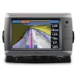
GPSMAP 720 Int GPS, 7'' diagonal
Standalone chartplotter, built-in radar port, 7" diagonal touchscreen, worldwide basemap, XM weather and radio compatible, NMEA 2000 capable, high-sensitivity GPS receiver, sounder version available
GPSMAP 720 is a stand-alone touchscreen chartplotter that brings a new level of functionality to your vessel.
Featuring a brilliant 7" (17.78 cm) display, GPSMAP 720 puts all the information you need right at your fingertips. GPSMAP 720 is preloaded with a worldwide basemap and accepts additional map data for greater flexibility. In addition, GPSMAP 720 accepts radar input and offers full NMEA 2000 connectivity for greater convenience when adding extra sensors.
View Worldwide Basemap
GPSMAP 720 comes with a worldwide basemap and features an internal, high-sensitivity GPS receiver for superior satellite tracking and quicker acquisition times.
And as an added benefit, GPSMAP 720 can receive graphical weather data for North America through the optional GXM 51 satellite receiver/antenna.
Take Control by Touch
Input is easy with GPSMAP 720. Whether you're changing course or simply reviewing information in front of you, the intuitive touchscreen interface makes for simple operation.
The device also offers flexible brightness levels for daytime readability along with low-light dimming during night use. And with a widescreen display that's rugged and waterproof, it's made to perform in any situation.
Expand with Radar
Featuring a built-in radar port, GPSMAP 720 can be interfaced with Garmin's line of affordable GMR marine radar systems.
Whether you're adding radar now or in the future, you'll enjoy the convenience of plug-and-play installation as well as the power, range and high-definition targeting of our proven radar offerings.
Add Sonar with GPSMAP 720s
GPSMAP 720s comes standard with a 1kW capable sonar transceiver.
This powerful sonar can help you define fish targets and underwater structures as far down as 2,000 ft (609.6 m) when used with a 1kW transducer.
Add Extras with BlueChart g2 Vision
With the optional BlueChart g2 Vision SD card, you can add a whole new dimension of exceptional features to your chartplotter.
MarinerEye view and FishEye view provide a 3-D perspective of map information, both above and below the waterline.
High-resolution satellite images and aerial photographs help you orient yourself in unfamiliar areas.
Auto Guidance technology searches through all relevant charts to create a route you can actually follow - one that avoids obstacles, shallow water, buoys and other obstructions.
Garmin Marine Network not supported.
Depth capacity is dependent on water salinity, bottom type and other water conditions (with 1 kW transducer).
Package Includes
GPSMAP 720
Top and bottom snap covers
Bail mount with built-in cable management
Knobs
Flush mount gasket and hardware
Threaded power/data cable (720)
Protective cover
Documentation
GPSMAP720 Features:
Unit dimensions, WxHxD: 22.4x 14.2 x 7.9 cm
Display size, WxH: 15.2 x 9.1 cm & 17.8 cm diag
Display resolution, WxH: 800 x480 pixels
Display type: WVGA display
Weight: 1.1kg
Battery: none
Battery life: none
Waterproof: yes (IPX7)
High-sensitivity receiver: yes
Antenna: Internal
NMEA input/output: NMEA 0183 compatible and NMEA 2000 certified
Basemap: yes
Preloaded maps: no
Ability to add maps:yes
Built-in memory:none
Accepts data cards:SD card slot
Waypoints: 3000
Routes:100
Track log: 20,000 points; 50 saved tracks
Garmin radar compatible: yes
Garmin sonar compatible:yes (included with sounder version)
 Related Products
You can find similar offers for Garmin Gpsmap 720 products with our WhatsApp search.
Stay informed about the best deals and price drops. Choose which notifications you'd like to receive from PriceCheck.


