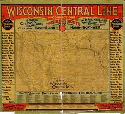
Map: 1880 Of The Wisconsin Central Line And Connections. Of The Western United States Framed In Border Giving Major Stations Along The Route And


Map: 1880 Of The Wisconsin Central Line And Connections. Of The Western United States Framed In Border Giving Major Stations Along The Route And
1880 map of the Wisconsin Central Line and connections. Map of the western United States framed in border giving major stations along the route and a shippers guide. Shows relief by hachures, drainage, cities and towns, state boundaries, and the railroad network with named lines. The main line emphasized in heavy black. more details

R1 170.00 from WantItAll.co.za

price history Price history

BP = Best Price   HP = Highest Price

Current Price: R1 170.00

loading...

 Comparing 1 offers

Features
Brand Unbranded
Manufacturer Unbranded
Model Number B072329C5F
Description
1880 map of the Wisconsin Central Line and connections. Map of the western United States framed in border giving major stations along the route and a shippers guide. Shows relief by hachures, drainage, cities and towns, state boundaries, and the railroad network with named lines. The main line emphasized in heavy black.
This site is protected by reCAPTCHA and the Google Privacy Policy and Terms of Service apply.